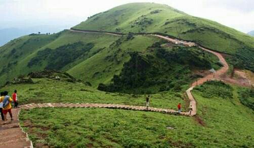
PEAK HEIGHT :
Highest peak in Karnataka. 1,930 meters (6,330 ft) from sea level.


LOCATION :
Chikamagaluru or Chikmagalur (District ) > Karnataka (State) >India (Country) .
TREK STARTING POINT :
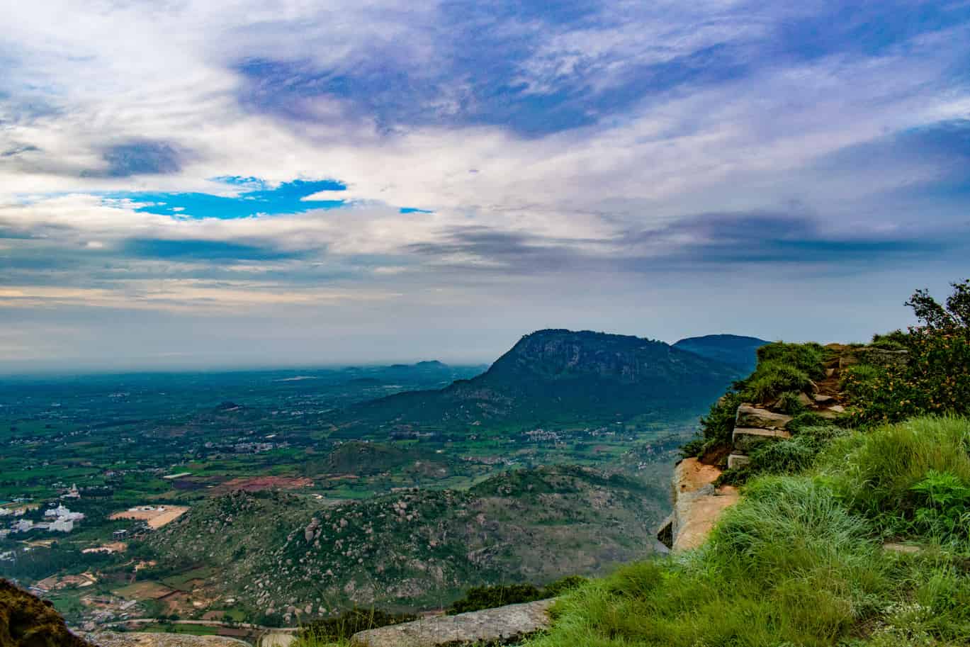
Sarpadhari. Sarpadhari is kannada word which means path like a snake, ‘sarpa’ stands for snake and ‘dhari’ for way.
HOW TO REACH: From Chikmagalur proceed towards Bababudangiri, near Kaimara you have to take left turn (8 kms from Chikmagalur). You will hit Y intersection, Your left side road goes to mullayanagiri peak(direct road till peak ). If you want to trek then just move straight further 500 mts. You will find small arch towards your left. That is called Sarpadhari. This will be your starting point.
If you are going by public transport :There are KSRTC buses from Bangalore to Chikmagalur. You can hire jeep from Chikmagalur to Sarpadhri. You can hire auto (If your team head count is 3-4) also they will charge Rs 250.
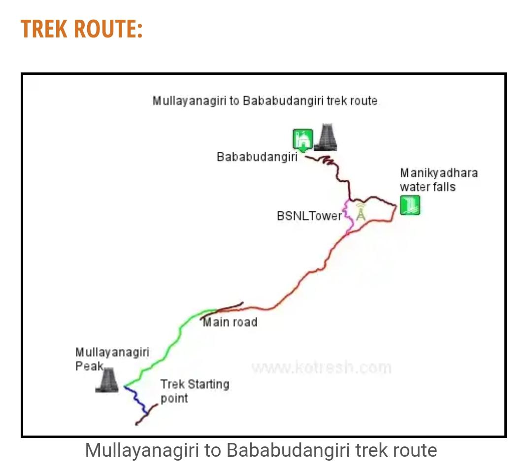
Next stretch is marked in green line. This stretch is from Mullayanagiri peak to main road. This is easier stretch because most of time you need to descend. You will hit main road. You need to cross the road.
Next stretch is marked in red line in above map. This is from main road to Bababudangiri. This part of the trek is difficult. You have to trek on to narrow ridge. On the way you will find BSNL tower which is another landmark in this trek. Warning: Near to BSNL tower stretch is quite steep and dangerous. Pay more attention while trekking. Pink Line marked in Map takes you to main road(we took this route). From main road you can go to Manikyadhara or Bababudangiri
From Manikyadhara to bababudangiri stretch is very easy, its tar road. If you tired then you will get auto/some private vehicle till Bababudangiri.


You must be logged in to post a comment.